High Willhays and Yes Tor: Dartmoor’s Two Mountains
Dartmoor is famous for its granite tors, open moorland and big skies. But did you know that two of its summits rise above 2,000 feet? High Willhays and Yes Tor share that distinction — and it is why they are often described as Dartmoor’s only two mountains.
How high are they?
| Summit | Height | Place on Dartmoor |
|---|---|---|
| High Willhays | 621 metres | Highest |
| Yes Tor | 619 metres | Second highest |
The pair stand close together on northern Dartmoor, south of Okehampton. High Willhays takes the top spot, but its neighbour is only a little lower. Both clear the 2,000-foot mark, which is exactly 609.6 metres.
Heights follow Dartmoor National Park’s general information factsheet. Other survey datasets may give slightly different measurements.
What makes them “mountains”?
There is no single definition used by everyone. The familiar description of Dartmoor’s “two mountains” uses the traditional 2,000-foot height convention. It is more precise to say these are Dartmoor’s only two summits above that level.
Some classifications use 600 metres instead, and others also require a certain drop between neighbouring summits. So “above 600 metres” and “above 2,000 feet” are not interchangeable. Cut Hill and Hangingstone Hill also exceed 600 metres, but fall short of 2,000 feet.
High Willhays: the top of Dartmoor
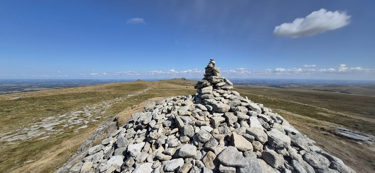
High Willhays is a summit of weathered granite outcrops and open horizons. Its height is not announced by a towering rock face: the sense of being up high comes from the moorland stretching away around it.
I reached High Willhays on my Willsworthy circular on 22 August 2026. That was a demanding 12.5-mile day, with steep climbs, valleys and river crossings. I stopped at the summit for photographs and the views before heading down again. The photograph above comes from that outing.
Yes Tor: a close neighbour
Yes Tor has a rocky summit with an Ordnance Survey trig pillar. At 619 metres, it is almost level with High Willhays, which lies to its south. The two make a natural pairing for a carefully planned walk, but the distance between them is only one part of the day: your starting point and return route determine the overall effort.
It is worth enjoying each summit for its own character. One has Dartmoor’s highest ground; the other has that recognisable trig pillar and its own wide outlook across the moor.
Plan for exposed moorland
These are open, exposed summits. Low cloud can hide landmarks, wind can make a stop uncomfortable, and wet ground can slow progress. Check the forecast, allow enough daylight and carry suitable layers, waterproofs, food, water and navigation equipment you know how to use. See my hiking kit list and Dartmoor safety guide.
Check the Okehampton firing range
Both summits are within the Okehampton military training area. Check the official Dartmoor firing times before setting out, including any other ranges your route crosses. Do not enter a range when red flags or red lamps are displayed. Never touch military debris; note its location and report it to the Training Safety Officer or police.
Whether you call them mountains or high moorland summits, High Willhays and Yes Tor are two distinctive places to explore. The height gives you a reason to go; the landscape gives you a reason to linger when conditions allow.
Read my High Willhays walk report →
Sources and further reading
- Dartmoor National Park: summit heights (PDF)
- Ordnance Survey: Yes Tor trig pillar
- OS GetOutside: hill and mountain classifications
- OpenFell: Dartmoor summit list, using Database of British & Irish Hills data
- Ministry of Defence: Dartmoor firing times and range warnings
Checked 28 October 2026. This article introduces the summits; use a current map to plan your route.